

DataFarming aims to offer growers cheap and easy access to satellite imagery

To get more growers to use satellite imagery, Australian company DataFarming offers an easy-to-use, mass market and low price point digital platform. “Most agtech software companies will fall in the trap of over-complication”, Co-founder Tim Neale says.
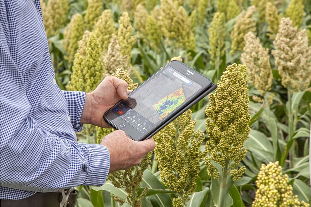
Mr Neale co-founded DataFarming with his wife Peta in 2017. The company has developed a web application that delivers satellite imagery to any farmer in the world. “This really helps them to understand the variability in their crops and pastures”, Mr Neale says. “Off the back of that, we provide variable rate application maps, that helps growers and agronomists with fertiliser inputs and soil amelioration.”
DataFarming currently has 30,000 farms on its platform. It has serviced 125,000 paddocks. 85% of its users are in Australia, where the company has a 40% market penetration. The number of users in other countries is rapidly growing, particularly in Europe. “In the future, we want to look more at South-East-Asia, Africa and potentially the US”, Mr Neale says.
Text continues below video
Slow growth of big data use in agriculture
The DataFarming co-founder points out that the growth of big data use for greater productivity has been slow in recent years. “The problem is that agtech companies in particular have not developed simple and intuitive tools. The quality of the services and products on the market was poor. That has been the cause of poor adoption. It’s a small market, and there was not enough investment. And that’s what it needs to build these intuitive products.”
But Mr Neale has seen a big change recently. “There is much more investment in agtech now. I think we will see a big improvement in the quality of the agtech products that are entering the market.” DataFarming has recently been seeking investment for an AUS $5 million (US $3.42 million) Series A raise on the Australian Growag platform, to build out its product suite and scale globally.
So far, the interest of investors has been good. “It has been incredible, with interest from our users – individual farmers – right through to venture capital groups. Private companies, agronomy firms, fertiliser companies, you name it. This has given us the capital we need to build our products out. We don’t have to just rely on organic growth.”
Growers can just sign up with us and get started
The Australian agtech company wants to offer a light touch, mass market and low price point digital platform. “That’s our key differentiator. We have no barrier to entry. Growers can just sign up with us and get started with satellite imagery. They will get the base product for free and will only pay for what they need. We really try to get farmers engaged in trying new technology. And that will lead to them going on a journey of doing things in new ways and using new products and services.”
Text continues below image
Keeping costs low
Meanwhile, DataFarming is keeping its costs low by scaling without hiring new people. “Al lot of other companies have lots of sales people running around. We won’t be doing that. And the number one comment we get back, is that DataFarming is easy to use. It might seem simple but in the software world that is very hard to do. Most companies will fall in the trap of over-complication.”
Apps for consumers that succeed are simple and intuitive. We have to deliver the same thinking in the agricultural industry.
According to Mr Neale, it is currently is almost impossible to get access to simple layers of information, like satellite data or yield mapping. “Because the software that has been built, is so complicated. It is only suitable for the top 10% of farmers out there. But what about the other farmers? The apps for consumers that succeed are simple and intuitive. We have to deliver the same thinking in the agricultural industry.“
With its easy-to-use products, DataFarming is trying to lead farmers to an action on the ground. “Either with variable rate application of fertilisers or salt testing on the right locations. That kind of thing. The other products that we offer, revolve around multiple year analysis, 5-year stacks, so farmers can see long term trends.”
Delivering images with a high resolution
DataFarming also aims to differentiate by delivering images with a high resolution. “Many of the other platforms you see, are based on 10-metre resolution satellite data. We now source down to 30-centimetre resolution. Farmers can be more confident in the differences they are seeing. If you’re in a vineyard for example, a 10 metre by 10 metre pixel could cover 3 vineyard rows. But with the higher resolution, you can see every vineyard row.”
Mr Neale emphasises that most landholders in South East Asia for example operate farms that are smaller than half a hectare. “So, a 10-metre pixel resolution in there is pretty much useless. The average farms size in France is only 40 hectares. In the UK it is around 30 hectares. The high resolution satellite imagery is much more suited to smaller landholders, as well as to intensive crops, like tree crops or crops on vineyards. On an orchard you can see every single tree.”
It’s all upside in agriculture right now
With its capital raise, DataFarming would like to do more in the space of yield mapping, carbon testing, salt testing and weather forecasts. Currently, agriculture is weathering the storm of investment blows, Mr Neal says. “It’s the cool kid on the block. It’s all upside in agriculture right now. With Covid, people went back to the basics of food production. The war in Ukraine has put pressure on food supplies globally. And with new technology there is an opportunity for farmers to do a better job, around sustainability as well. Agriculture has a key role to play in helping to remediate climate change.”
With the latest commercial satellites some level of space surveillance of crops and fields can be achieved. Farmers can also benefit from the satellite imagery with increasing detail that become readily available at increasing cadence. Read why you cannot hide from the satellite!
Join 17,000+ subscribers
Subscribe to our newsletter to stay updated about all the need-to-know content in the agricultural sector, two times a week.


