DroneDeploy 360 Walkthrough monitors from any angle

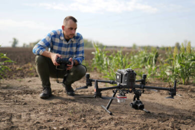
Through its new feature, 360 Walkthrough, DroneDeploy now works with both drones/aerial cameras and any on-the-ground 360-cameras (hand-held or robotic) to provide a comprehensive digital reconstruction of any site. The new technology would allow farmers to monitor their sites from any angle, on one platform.
The offering has already been tested and proven in collaboration with mobile robot creator Boston Dynamics, and construction companie Brasfield & Gorrie. The new product and collaborators were unveiled on the first day of DroneDeploy’s annual DroneDeploy Conference, happening virtually October 13 and 14, 2020.
Combining aerial, interior and ground data
“We know our customers are looking for a solution that allows data capture on the ground and indoors,” said Mike Winn, co-founder and CEO of
DroneDeploy. “Today, we’re responding to that need with 360 Walkthrough. By combining aerial, interior and ground data onto one platform, we’re providing our customers with a complete perspective of their sites, ultimately increasing efficiency and worker safety in industries like construction, agriculture, renewables, and more.”
Earlier this year, construction company Brasfield & Gorrie began collaborating with Boston Dynamics and DroneDeploy to develop an industry-first workflow for automating 360 video-based construction documentation.
Mobile robot
Brasfield & Gorrie helped develop and pilot a workflow to perform on-the-ground building walkthroughs and inspections using the agile mobile robot “Spot” by Boston Dynamics, along with DroneDeploy’s 360 Walkthrough.
Outfitted with a 360-camera, Spot allows workers to autonomously capture data from building interiors and take close-up photos for the bid process or inspection. Using the Spot and DroneDeploy SDKs, Brasfield & Gorrie specialists are able to automate the full process, from mobile data capture to cloud upload and image processing, immediately making the data available for other project team members to view using DroneDeploy.
With this new workflow, superintendents and project managers can easily and efficiently gather the data they need to obtain a comprehensive view of their job site, from any perspective.
Text continues underneath video
In addition to 360 Walkthrough, DroneDeploy announced its October Product Release. These include Vertical Flight, which provides autonomous flight templates for projects like multi-story buildings or storage tanks, with new immersive 3D inspection tools. Additional features include new analytical tools for Construction and Earthworks companies, next AI-driven generation photogrammetry and super high-res 360 panorama processing.
Join 17,000+ subscribers
Subscribe to our newsletter to stay updated about all the need-to-know content in the agricultural sector, two times a week.