AI and drones aid farmers with identifying botrytis

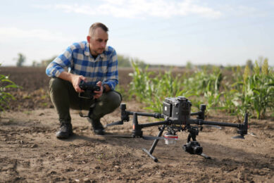
Researchers from Unmanned Valley, Greenport DB, and NL Space Campus in the Netherlands have successfully developed an AI model that enables drones to identify the disease botrytis.
The model leverages artificial intelligence to analyze vast amounts of drone data, resulting in a detailed map that pinpoints, with millimeter precision, which plants are diseased or at risk. This innovation could significantly reduce the use of crop protection agents. The final results of the ‘Remote Sensing for Horticulture’ project were presented this month.
The European Union aims to substantially reduce the use of pesticides in the coming years, as part of the European Green Deal, with the goal of making Europe the world’s first climate-neutral continent by 2050. Excessive use of pesticides poses risks to water quality and biodiversity, among other things. By early and accurate detection of conditions that could harm crops, these substances can be applied more precisely, significantly reducing their usage.
Diseases in different crops
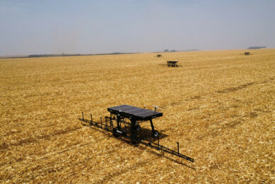
Currently, the model is only capable of recognizing botrytis in tulips and hyacinths. However, it is expected that with a few minor adjustments, the model could also detect other diseases in different crops. This is a very interesting development for growers, not only from an environmental perspective but also for potential cost savings, such as reducing the risk of crop failures, not having to purchase large quantities of crop protection agents, and eliminating the need for manual field inspections, which can never cover every plant. Additionally, the researchers used an easily obtainable and relatively inexpensive drone that can even perform missions fully automatically, though a pilot is still required to be present for now.
The ‘Remote Sensing for Horticulture’ project will continue. Efforts will be made to improve the accuracy of the measurements by combining drone data with satellite imagery and current information on soil and weather conditions. Moreover, several large companies from the agri-sector have expressed interest in exploring whether the technology can detect other diseases in different crops. The scalability of the techniques and the development of the business model will also be examined.
Join 17,000+ subscribers
Subscribe to our newsletter to stay updated about all the need-to-know content in the agricultural sector, two times a week.