Drone measures radioactivity in the soil

A PhD-student at the University of Groningen (RUG) in the Netherlands has developed a method for using a drone to measure radioactivity in the soil from the air.
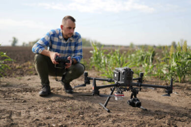
In order to measure radioactivity in the soil the drone is equipped with a smart sensor. Measuring the levels of radioactivity can be valuable to farmers, according to the study ‘UAV-borne radioelement mapping: towards a guideline and verification methods for geophysical field measurements’.
Radioactivity in the soil indicator for soil health
The level of radioactivity in the soil provides information about the type of soil. It can for instance be used to determine how fertile the soil is, or how much minerals are present. It’s also an indicator for soil moisture. And this information can the be used by growers for optimising (variable rate) application of fertiliser, or optimise their irrigation strategies.
Until recently, such measurements were done from the ground using large and heavy detectors. In his PhD research, Steven van der Veeke has developed a method to do this measurement with a drone from the air. As a result, the measurement area no longer needs to be disturbed and it is now possible to use this technique in areas that are inaccessible from the ground.
Join 17,000+ subscribers
Subscribe to our newsletter to stay updated about all the need-to-know content in the agricultural sector, two times a week.